Key Features of Navigation Auxiliary Equipment:
- Echo Sounders and Depth Finders:
- Accurate Depth Measurement: Echo sounders and depth finders use sonar technology to measure the depth of water beneath the vessel, providing real-time data that helps avoid grounding and identify safe anchoring spots.
- Fish Detection: Some models also detect fish and underwater structures, offering dual functionality for both navigation and fishing.
- Gyrocompasses:
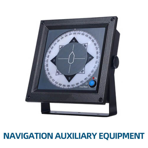
- True North Indication: Unlike magnetic compasses, gyrocompasses provide accurate readings of true north, unaffected by magnetic anomalies, ensuring precise heading information essential for long-distance navigation.
- Integration with Autopilot Systems: Often linked with autopilot systems to maintain a steady course, reducing the need for manual adjustments.
- Marine Sextants:
- Celestial Navigation: Traditional tools used for celestial navigation, allowing navigators to determine their position by measuring the angle between celestial bodies and the horizon.
- Backup Navigation: Serves as a reliable backup to electronic navigation systems, particularly useful in situations where GPS or electronic systems fail.
- Speed Logs:
- Water Speed Measurement: Speed logs measure the vessel’s speed through water, providing crucial data for accurate navigation and fuel efficiency.
- Doppler and Electromagnetic Models: Available in different types, including Doppler and electromagnetic logs, each offering unique advantages for precise speed measurement.
- Radar Reflectors:
- Enhanced Visibility: Radar reflectors increase the visibility of small vessels on the radar screens of other ships, improving safety in congested or low-visibility areas.
- Passive Safety Device: A simple yet effective tool that does not require power, making it a reliable addition to any vessel.
- Marine Chronometers:
- Precise Timekeeping: Highly accurate timepieces essential for celestial navigation, enabling the calculation of longitude based on time and celestial observations.
- Synchronization with GPS: Although primarily a traditional tool, modern chronometers can be synchronized with GPS for enhanced navigational accuracy.
- Barometers and Hygrometers:
- Weather Monitoring: Barometers measure atmospheric pressure, while hygrometers measure humidity, both providing critical information for weather forecasting and navigation planning.
- Predicting Weather Changes: These instruments help predict changes in weather conditions, allowing for timely course adjustments to avoid adverse weather.
- AIS (Automatic Identification System) Receivers:
- Vessel Tracking: AIS receivers allow the monitoring of nearby vessels, providing essential information such as position, speed, and course, enhancing collision avoidance.
- Data Integration: Often integrated with chart plotters and radar systems to provide a comprehensive view of surrounding traffic.
- Wind Indicators:
- Wind Speed and Direction: Provide real-time data on wind speed and direction, crucial for sailboat navigation and for planning maneuvers in powered vessels.
- Mechanical and Electronic Models: Available in both traditional mechanical designs and modern electronic versions that can integrate with onboard systems.
- Navigation Lights and Signals:
- Visibility and Compliance: Essential for ensuring the vessel is visible to others, especially at night or in poor visibility conditions. Includes running lights, anchor lights, and special signaling lights.
- Regulatory Compliance: Meets international maritime regulations, ensuring that the vessel is equipped with the appropriate lights for its size and operational status.
- Rudder Angle Indicators:
- Steering Control: Displays the angle of the rudder, helping the helmsman maintain the desired course and execute precise maneuvers, especially during docking or tight turns.
- Integration with Autopilot: Often linked to autopilot systems to provide feedback and ensure accurate course keeping.
- Fog Signals and Horns:
- Audible Warnings: Essential safety equipment that emits sound signals to alert other vessels of the ship’s presence in fog or low visibility conditions.
- Compliance with Regulations: Meets maritime safety regulations for sound signaling, ensuring the vessel can communicate effectively in various conditions.
- Navigation Software and Apps:
- Route Planning and Optimization: Advanced software tools that assist in planning efficient routes, considering factors like currents, weather, and vessel performance.
- Real-Time Updates: Provide real-time data on navigation, weather, and other critical information, enhancing decision-making on the bridge.
Navigation Auxiliary Equipment is vital for enhancing the safety, accuracy, and efficiency of maritime navigation. These tools and devices, ranging from traditional instruments like marine sextants to modern technologies like AIS receivers, support navigators in all aspects of their duties. Whether used for precise positioning, weather monitoring, or course plotting, this auxiliary equipment ensures that vessels can navigate safely and efficiently through various maritime conditions.


