Key Features of Navigation Equipment:
- GPS (Global Positioning System) Receivers:
- Real-Time Positioning: GPS receivers provide accurate real-time positioning data by triangulating signals from satellites, allowing navigators to determine their exact location anywhere on the globe.
- Route Planning and Tracking: Enables precise route planning and monitoring, helping to ensure the vessel stays on course and reaches its destination safely.
- Radar Systems:
- Obstacle Detection: Radar systems emit radio waves to detect objects around the vessel, such as other ships, landmasses, and navigational hazards, even in low visibility conditions like fog or at night.
- Collision Avoidance: Provides crucial information for avoiding collisions by tracking the movements of nearby vessels and calculating potential collision courses.
- Chart Plotters:
- Digital Navigation Charts: Chart plotters display electronic navigation charts (ENCs) and integrate with GPS to provide a visual representation of the vessel’s position, helping navigators plan and monitor routes.
- Multifunction Displays: Often combined with other systems, such as radar, AIS, and sonar, to offer a comprehensive overview of navigational data on a single screen.
- Autopilot Systems:
- Automatic Course Keeping: Autopilot systems maintain the vessel’s course automatically, reducing the workload on the crew and improving navigation accuracy, especially during long voyages.
- Integration with Navigation Equipment: Often integrated with GPS and chart plotters to follow pre-set routes, allowing for hands-free navigation.
- Gyrocompasses:
- True North Reference: Gyrocompasses provide accurate heading information by referencing true north, unaffected by magnetic fields, making them essential for precise navigation.
- Stability and Accuracy: Gyrocompasses are more stable and accurate than magnetic compasses, especially on larger vessels and during extended voyages.
- Magnetic Compasses:
- Reliable Directional Guidance: Magnetic compasses provide a simple and reliable means of determining the vessel’s heading relative to magnetic north, serving as a crucial backup to electronic systems.
- Durability and Simplicity: Known for their durability and simplicity, magnetic compasses are an essential part of any vessel’s navigation equipment.
- Automatic Identification System (AIS):
- Vessel Identification and Tracking: AIS transponders send and receive information about the vessel’s identity, position, course, and speed to and from nearby ships and shore stations, enhancing maritime safety by improving situational awareness.
- Collision Avoidance: AIS data is integrated with radar and chart plotters to provide a comprehensive view of surrounding traffic, helping to avoid collisions.
- Echo Sounders and Depth Finders:
- Depth Measurement: Echo sounders use sonar technology to measure the depth of water beneath the vessel, helping navigators avoid shallow areas and grounding.
- Bottom Profiling: Provides a profile of the seabed, which can be useful for safe anchoring and detecting underwater hazards.
- Speed Logs:
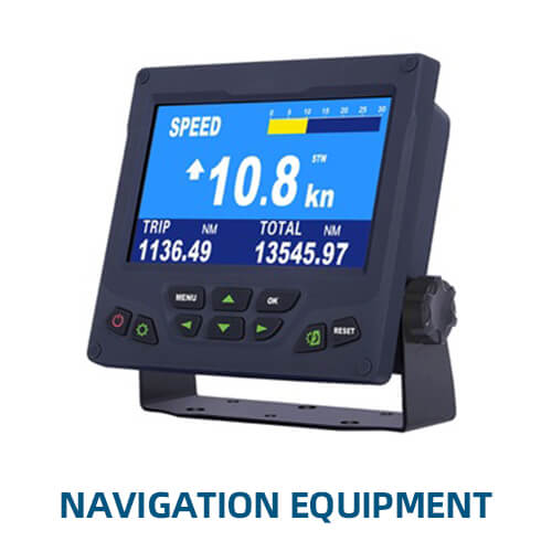
- Water Speed Measurement: Speed logs measure the vessel’s speed through the water, providing essential data for navigation and fuel management.
- Doppler and Electromagnetic Models: Different types of speed logs, such as Doppler and electromagnetic logs, offer varying levels of precision and are suited to different vessel types and navigation conditions.
- Marine Sextants:
- Celestial Navigation: A traditional instrument used for celestial navigation, allowing navigators to determine the vessel’s position by measuring the angle between celestial bodies and the horizon.
- Backup Navigation Tool: Marine sextants serve as a reliable backup to electronic navigation systems, especially in remote areas where GPS signals may be unreliable.
- Electronic Chart Display and Information System (ECDIS):
- Digital Navigation Tool: ECDIS is an advanced digital system that displays electronic navigational charts and integrates with GPS, radar, and AIS to provide a comprehensive view of the vessel’s navigational environment.
- Compliance with Regulations: ECDIS is required on many commercial vessels under international maritime regulations, serving as a primary navigation tool.
- Barometers and Weather Instruments:
- Weather Forecasting: Barometers measure atmospheric pressure, providing valuable information for predicting weather changes, while other instruments monitor wind speed, direction, and temperature.
- Navigation Planning: Accurate weather data is essential for safe navigation, helping to plan routes that avoid storms and adverse conditions.
- VHF Marine Radios:
- Communication: VHF radios are crucial for ship-to-ship and ship-to-shore communication, particularly for sending and receiving navigation warnings, weather updates, and distress signals.
- DSC (Digital Selective Calling): Modern VHF radios include DSC functionality, enabling automated distress calls with GPS coordinates, enhancing safety.
- Rudder Angle Indicators:
- Steering Feedback: Rudder angle indicators show the current position of the rudder, helping the helmsman maintain the desired course, especially during maneuvers.
- Wind Indicators:
- Wind Speed and Direction: Wind indicators provide real-time data on wind speed and direction, which is critical for sailboat navigation and for adjusting course in powered vessels.
- Fog Signals and Sounding Devices:
- Safety in Low Visibility: Fog signals and sounding devices are essential for alerting other vessels to your presence in foggy conditions, preventing collisions.
Navigation Equipment is the backbone of safe and efficient maritime operations. From modern electronic systems like GPS and radar to traditional tools like compasses and sextants, these instruments provide the critical information needed to navigate through any waters with confidence. Whether on a small yacht or a large commercial ship, reliable navigation equipment ensures that every journey is as safe and efficient as possible.


